Android/Andor's Trail
Andor's Trail will probably always be a work in progress...somehow that makes it even more charming.
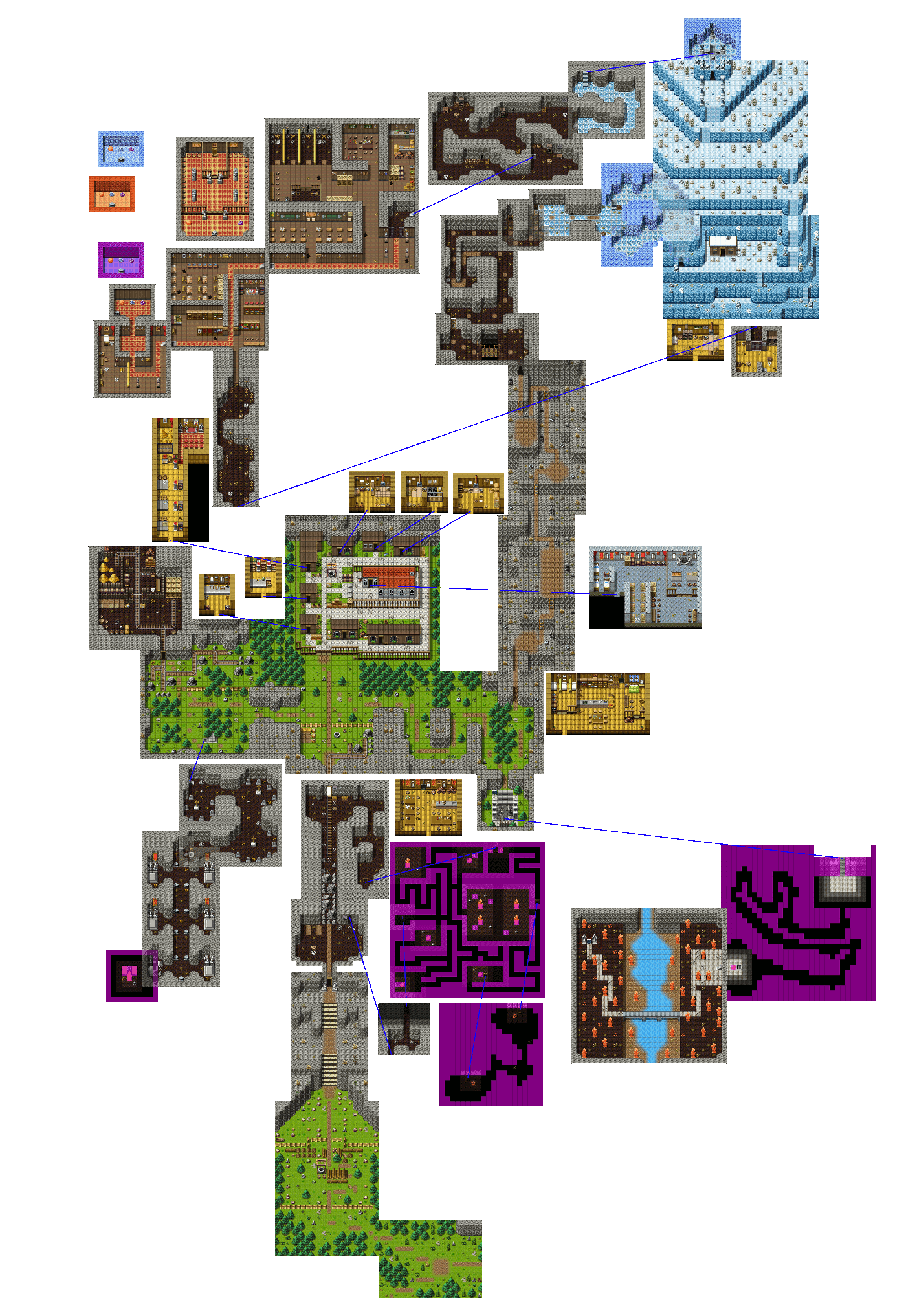
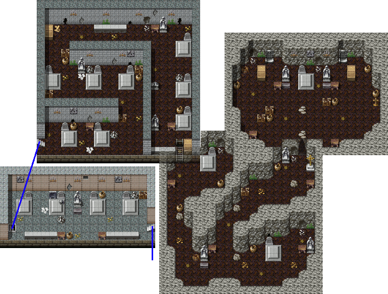
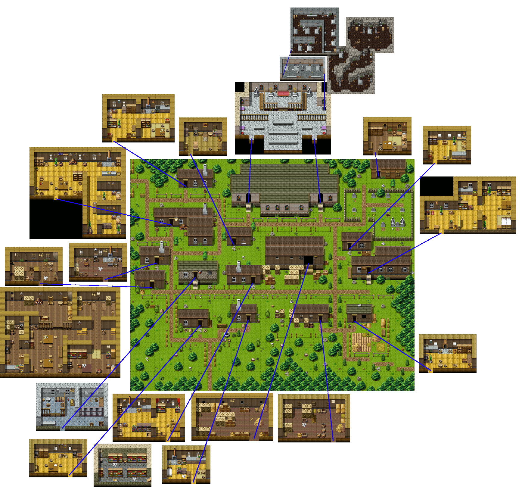
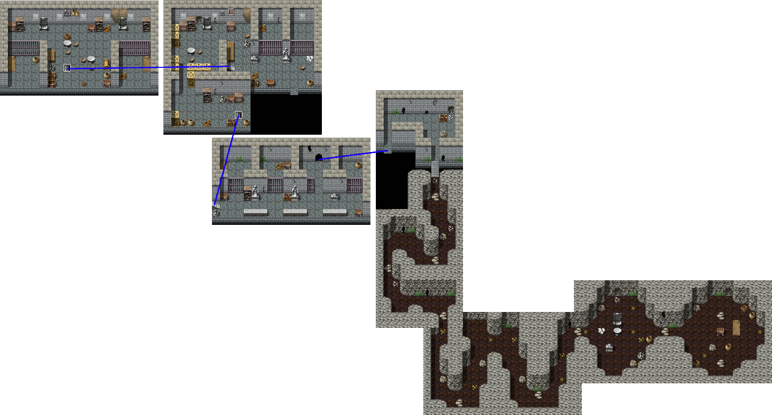
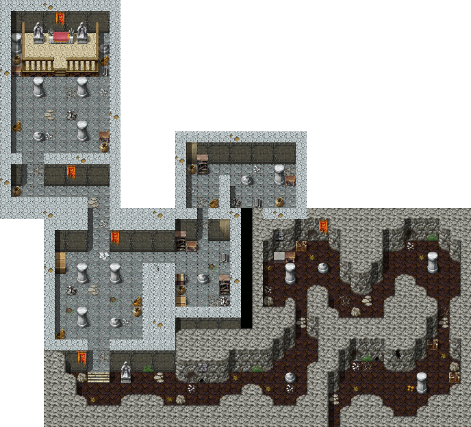
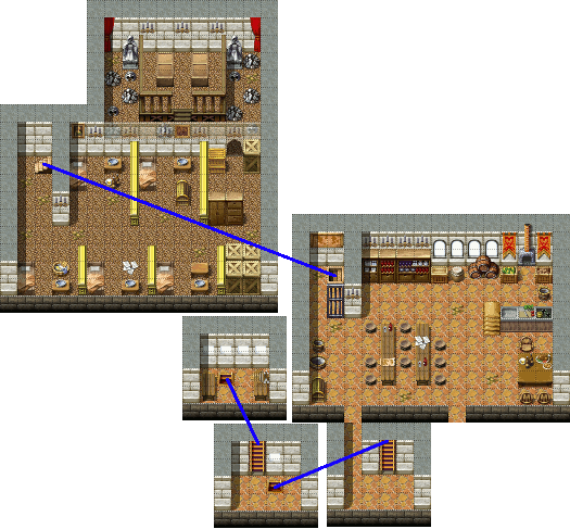
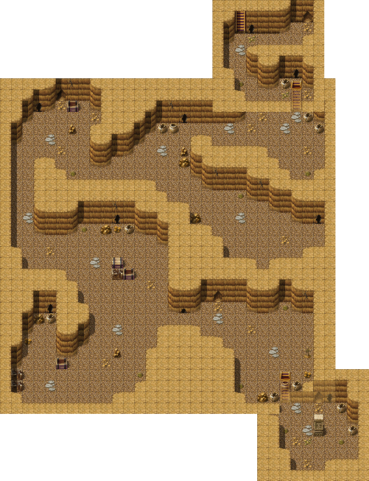
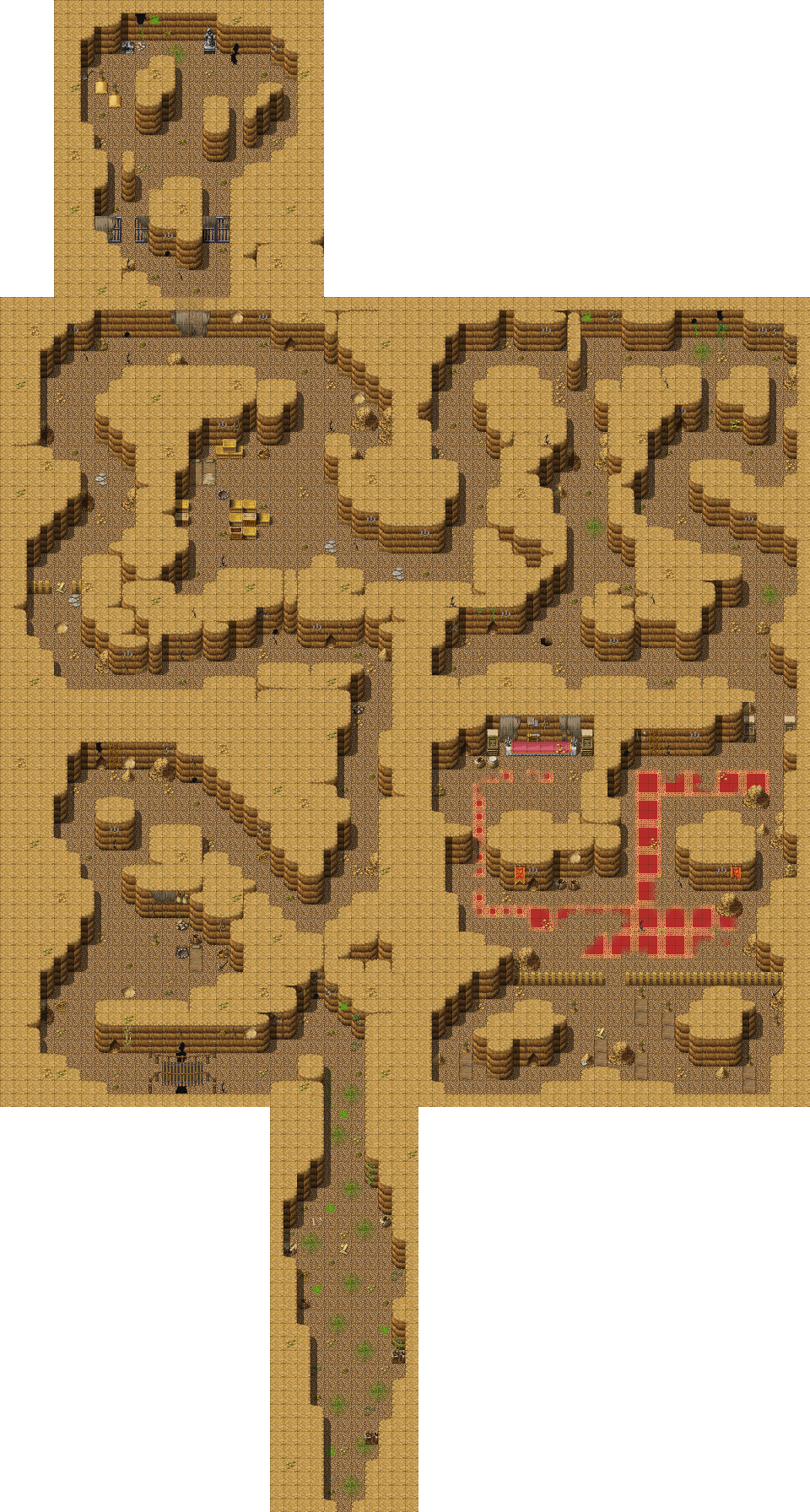
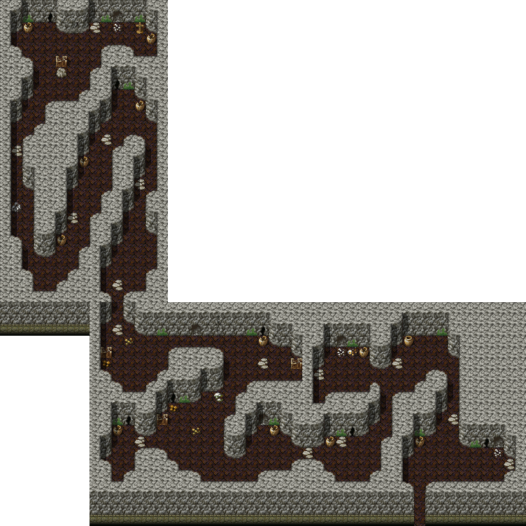
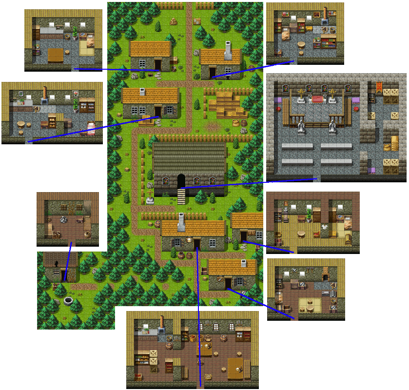
I enjoy playing it, but often wish I had a map. So I decided to make maps for it. It helps that the game is open source.
Contents |
Maps
I used Tiled and GIMP to create these. All source files are in .xcf (GIMP) format and available for download - click on the image name.
First, I converted all of the .tmx files from the source code folder 'res/xml' to images. Then I loaded those images into GIMP to create a single merged image.


To Do
- Finish the individual "site maps"
- Figure a way to link the world map to the site maps
- Create a separate page for an interactive world-map
- zoom in/out
- clicking entryways takes you to the proper map
- for now, stairways will be considered entryways
Maybe I'll Write a Program
While I'm editing the world map, I'm thinking..."The TMX files are XML...I should be able to write a program that would join them all together..."
I think I'll do it. In fact, I think I'll have to make it an interactive web page...better check the Tiled site to see if someone's already got something. Probably not, though, because the use of layers is per-application.
Anyone want to help? Send me an e-mail...theGleep - at - bigfoot - dot - com
Notes
- jquery
- show the map as tiles
- only show as many tiles as will fit on the screen/in the map rendering area
- use absolute positioning within the rendering area
- use z-index; each "level" gets a range of z-indexes so that we can do proper "layering"
- level 0 is [0..9]
- level 1 is [10-19]
- level -1 is [-10..-1]
- ? (level * 10) through ((level + 1) * 10) - 1) ?
- Identify level in the class attribute so it's easy to hide/show the entire level
- use Mapevents of type mapchange as links
- when return link is not on an outside edge of the map, it links to a separate layer
- how to tell if layer is above or below current layer?
- when moving to a new layer (clicking the Mapevent tile), hide all layers above the current layer
- when return link is not on an outside edge of the map, it links to a separate layer
- support zooming (maybe even a custom zoom control like Google Maps) Hmmm...could we take advantage of Google Maps for this?
- preload all the tiles to improve rendering time
Maybe I'll even try to port it to a web-based version?
- MelonJS looks like a good framework for this